
Tracing a Riverbank Street Directory Search
A street-by-street question works best when each parcel gets its own record trail. The practical chain is address to APN, assessment roll, recorded document, permit or code file, and historical listing. For a Riverbank street directory, keep three labels apart: owner of record, mailing addressee, and listed occupant. A deed can establish a transfer. A roll can identify the owner and tax-mail destination. A reverse directory can show a name tied to an address for a particular year. None of those alone proves who is inside a home today.
Start with the Stanislaus County GIS Hub and a known address. The map can help place parcels, city limits, annexations, county islands, districts, and transport layers. The separate Riverbank GIS service returned an error during research, so exact city-viewer search fields and popup controls remain unverified. Record what the county map can show, then confirm parcel identity with the Assessor before treating a street match as a record match.
- Resolve the parcel. Browse the county map, note every APN along the chosen stretch, and mark where the city line or an annexation changes the record context.
- Check the assessment trail. Use the APN in Public Inquiry, or ask at the Assessor counter for the public ownership and property fields available for that parcel.
- Follow the recorded documents. Take the current owner, APN, legal description, or document number into RecorderWorks and trace deeds, liens, releases, and maps.
- Keep voter evidence narrow. My Voter Status checks the person entering identity data. It is not a street browser; a broader voter file needs an approved purpose and application.
- Add people evidence by period. Request permits or code files by address or APN, then use Haines reverse volumes for listed occupants from 1971 through 1990 when the collection is available.
Riverbank Street Records: Parcels and APNs
An APN, or Assessor’s Parcel Number, is the county’s parcel and map key. It lets a researcher move from geometry to an assessment entry without assuming that a postal address is indexed the same way in every office. County GIS separates parcel geometry from many assessment attributes, so a map outline is a starting point, not an owner record.
Riverbank’s street grid sits in a larger geography. The historic downtown follows the Santa Fe Street and rail corridor near the Stanislaus River, while Crossroads, Crossroads West, and the former Army plant or Industrial Complex appear in later planning areas. Use city-limit, annexation, and county-island layers to test jurisdiction. No verified Riverbank street-renumbering or renaming year was found, so an old address should be bridged with its APN, legal description, subdivision map, or recorded correction.
- Parcel
- A mapped piece of land tracked by the Assessor, usually identified in the roll by an APN.
- Situs address
- The physical property location carried on the assessment record.
- Mailing address
- The destination for assessment correspondence, which may differ from the situs and does not prove occupancy.
- Plat
- A recorded map that shows lots, blocks, boundaries, or subdivision relationships.
- Criss-cross directory
- An address-to-name listing for a past period, useful for historical clues but not a complete current household roster.
Riverbank Street Directory Records
Address-keyed records answer different parts of a street directory question. The assessment roll centers on parcels and owners. GIS centers on location and boundary. RecorderWorks centers on recorded parties and instruments. Permits and code files show a person or contractor interacting with the City, while a reverse directory supplies a time-bound listed name. The coverage table keeps those roles distinct.
| Record Set | Keeper | What It Shows | Access |
|---|---|---|---|
| Assessment roll | Stanislaus Assessor | APN, owner of record, situs, mailing destination, values, exemptions, and characteristics | APN web search, counter, or restricted Agency Inquiry |
| GIS parcel layers | Stanislaus County GIS Hub | Parcel geometry, city limits, annexations, county islands, and districts | Free map and open-data hub; owner fields may be separate |
| Deeds, liens, and maps | Stanislaus Clerk-Recorder | Parties, document type, recording date, document number, book/page, and transfers | Free index, public terminals, and copy request channels |
| Voter records | California voter tools | Self-status, or approved file fields within a lawful purpose | Identity-gated self-check or qualified application |
| Permits and code files | Riverbank Development Services | Applicants, contractors, scope, inspections, entitlements, or address-linked compliance | Counter, published submission route, or focused CPRA request |
| Reverse directories | Stanislaus County Library Special Collections | Listed occupants and address evidence for a stated year | Library referral, remote query, or available shelf access |
Chain the sets with the APN and document number, not with a name alone. The roll can point to a recorded document; the document can establish a transfer; a permit can date work at the parcel; a directory can show a listed person for one period. A street directory result is strongest when the same address, legal description, and time frame agree across sources.
Riverbank Assessor Records and Search Fields
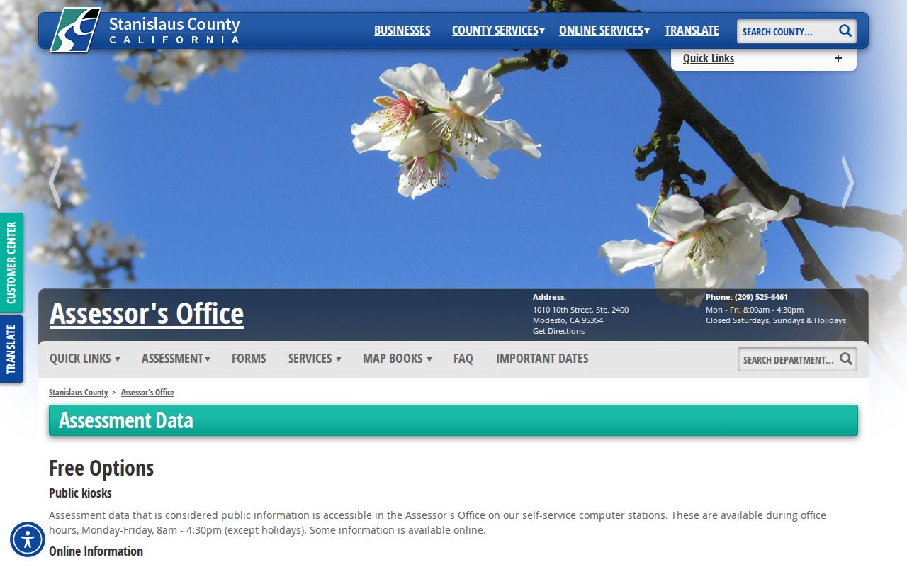
The Stanislaus Assessor Public Inquiry is APN-gated. An anonymous user agrees to the disclaimer, enters a parcel number, and receives basic assessment and property characteristics. The office at 1010 10th Street, Suite 2400, Modesto, provides public counter and kiosk access Monday through Friday, 8:00 to 4:30, at 209-525-6461. A richer name and situs route is available at the counter or through the restricted Agency Inquiry service.
The Assessor data-subscription route documents Agency Inquiry at $300 per year for up to five users, with registration, an agreement, and a demonstrated business need. That route can include owner, property address, mailing address, values, exemptions, land and improvement characteristics, sales, and document numbers. The mailing field is useful for record tracing, but it is not proof that the owner lives at the parcel.
The captured Assessor access view helps distinguish the free APN path from the richer service. It comes from the county’s own Agency Inquiry information, rather than from a general name browser.
For a reproducible Riverbank address trail, write down the APN, roll year, owner formatting, situs, mailing destination, exemption label, and any referenced document number. Validate stale or unclear data with the Assessor before relying on a match.
| Field | Route | What to Record |
|---|---|---|
| Parcel Number | Public Inquiry and richer routes | APN used to tie the map, roll, and deed search together |
| Name | Counter or Agency Inquiry | Owner-name field; not an anonymous web street browse |
| Situs / Property Address | Counter or Agency Inquiry | Physical address tied to the assessed parcel |
| Ownership | Assessment result | Owner of record, subject to protected-address rules |
| Mailing Address | Counter or richer product | Assessment correspondence destination, not occupancy proof |
| Assessed Values and Exemptions | Assessment result | Roll characteristics and exemption indicators |
| Land and Improvement Characteristics | Assessment result | Public property-character fields where available |
| Sales and Document Numbers | Assessment result | Links for a follow-up RecorderWorks search |
Riverbank Street Records in RecorderWorks
Comparison. RecorderWorks is the deeper online path when a street search moves from parcel to document. Its tabs include Home, Name, Document Number, Document Type, Map, Recording Date, Book and Page, Parcel Number, and Options. Name search uses LAST FIRST, accepts business names, allows partial matching, and supports From and To recording dates. Other modes accept an APN, legal description, map type or date, book/page, or instrument number.
Read the return as an index, not as a complete image set. A result can show the indexed party and role, recording date, document type, instrument number or book/page, short description, and links for a map, APN, or legal index. A grantor is often the seller or transferor, while a grantee is often the buyer or transferee; in a lien or judgment, those roles can describe a debtor and creditor instead. Search the recording year, not only the year a deal occurred.
The Stanislaus Clerk-Recorder is at 1021 I Street, Suite 101, Modesto, 209-525-5250, with Spanish service at 209-525-5252 and fax at 209-525-5804. Hours are Monday through Friday, 8:00 to 4:00. The index is free online, while public workstations, inside-office terminals, and the current official-record copy form provide fallback channels. Keep the document number or book/page, parties, date, page count, copy type, return address, and payment details ready.
Insider tip. Public terminals expose older index and image paths. Before 1980, expect book/page work; from 1980, annual sequential instrument numbers are common. Office guidance points to images from 1978 forward, a 1920–1988 G/G index, and microfilm or fiche back to 1853.
Riverbank ZIP Clues for a Street Directory
95367 is the only official Riverbank delivery ZIP verified in the research. The Riverbank Post Office record lists 6501 Third Street, 209-869-0181, weekday retail hours of 8:30 to 5:00, and services such as PO Box Online, General Delivery, and carrier service. A postal boundary can include delivery geography outside incorporated Riverbank, so a ZIP match is not a city-limit match. Use APN and legal description when municipal status matters.
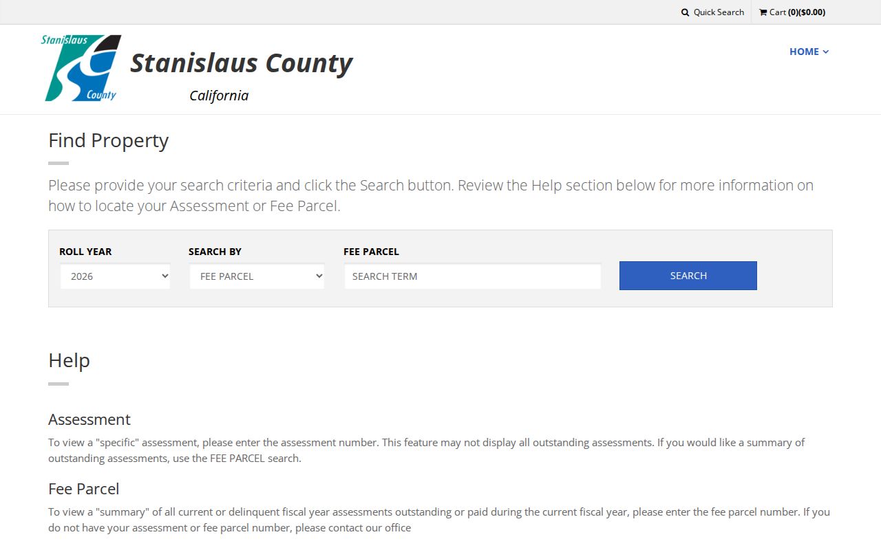
The Stanislaus Tax Collector search adds a Roll Year dropdown, Search By dropdown, Fee Parcel text field accepting 6 to 20 characters, Search, and Close. It is a free APN or fee-parcel search, not a name or street browse.
The captured tax screen comes from the official Stanislaus tax search. It shows why a tax lookup belongs after parcel resolution, rather than at the start of a Riverbank street directory search.
County GIS can map city limits, annexations, and county islands, but no ZIP-wide resident-result mode was verified. Postal wording is a routing clue, not proof of incorporation or voter eligibility.
Riverbank Street Records: Permits
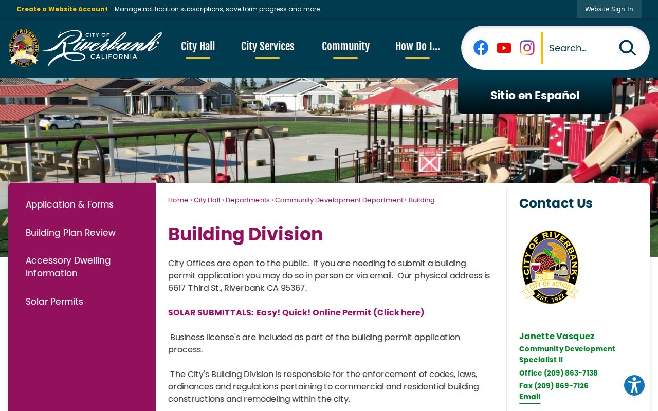
Riverbank Development Services and the Building counter are the fallback for permit history because no public address-keyed permit database was located. The office is at 6617 Third Street, 209-863-7127, Monday through Thursday, 7:30 to 5:30. Ask for the permit card, issued permits, final inspections, planning entitlements, and code cases tied to the address or APN. A packet may be submitted in person or through the published email route.
For broader City records, the Riverbank City Clerk CPRA form accepts email, fax, mail, or counter requests. It asks for a date, contact details, department, and a reasonably specific description. The City determines within ten days whether responsive records exist and advises the requester; that is not a promise to deliver all records in ten days. The form cites $0.10 per paper page and $0.75 per DVD under Government Code sections 7922.535 and 7922.530.
The Riverbank building-record page is the source for the local access view below. It is a useful reminder that an address history may require a counter request or focused CPRA description.
Permit applicants, contractors, scope, inspections, and dates can add time markers to a parcel trail. They do not turn an applicant name into proof of current residence.
Riverbank Voter Record Boundaries
My Voter Status requires First Name, Last Name, Date of Birth, and a California driver license, ID, or last four SSN input depending on the registration. It returns the individual’s registration status, party preference, polling or election information, and vote-by-mail status. It does not offer open street, ZIP, or neighbor browsing, so it cannot supply the voter step in a normal street directory search.
A qualified geographic file request follows a different channel. The California voter-file application asks for requester identity, organization, qualification, allowed purpose, security narrative, file type, geography, delivery method, ID, signature, and payment. Mail or hand delivery is required, not fax or email. Processing is stated as 7 to 14 business days. Charges are $15 per 1,000 records, capped at $100, or $30 for a specific voter, also capped at $100.
California Elections Code sections 2188 and 2194 and Government Code section 7924.000 restrict disclosure and use. Driver-license data, identity numbers, signatures, confidential voters, and other protected fields are excluded. Commercial or marketing use, harassment, unapproved transfer, and unsecured posting are prohibited. Stanislaus Elections is at 1021 I Street, Suite 101, Modesto, 209-525-5200, and Riverbank municipal elections are consolidated with the county.
Riverbank Street History in Older Records
Stanislaus County was organized in 1854, while RecorderWorks states that its online index reaches January 1, 1850. Preserve that mismatch as an index fact, not proof of a county office before organization. Riverbank emerged as a community in 1896, gained a railroad division terminal in 1910, and incorporated in 1922. Early county directories can therefore predate Riverbank proper.
The county Polk shelf runs 1910 through 1991, with many listed gaps; explicit Riverbank inclusion is confirmed for the 1958–59 and 1959–60 issues. Haines reverse volumes run nominally from 1971 through 1990, with catalog gaps. County telephone directories extend from 1966 through 1998. The Modesto Main Library Special Collections Room is closed during renovation through September 2026, so call the Stanislaus County Library before travel and use its remote query or digital routes when available. Collection-level history belongs with the Riverbank Directory Book.
When an older listing does not match a modern number, do not invent a renumbering date. Compare the APN, legal description, subdivision map, recorded correction, and nearby parcel geometry. That bridge can preserve continuity even when a street name or number changed outside the documented record.
Riverbank Street Records: Owner Notice
Riverbank’s planned-development instructions describe a precise owner-notification method. A project applicant must identify current owners for every parcel within 300 feet of the project perimeter. If fewer than 30 parcels fall inside, the radius expands until at least 30 parcels or a maximum of 1,000 feet. The submission includes a radius map, current assessment-roll copy, mailing labels and envelopes, and a title-company certification that the latest roll was used.
The required fields are owner name, mailing address, and APN. The City instructions describe an owner-notification list, not a resident or occupant roster. For informal street research, inspect surrounding APNs one at a time. The radius rule is a planning threshold, not permission to harvest personal identities.
Where a Riverbank Street Directory Stops
A parcel trail does not reveal every person associated with a home. Unlisted adults, children, guests, utility customers, and DMV address holders are not supplied by the public assessment and deed chain. A situs address identifies the property. A mailing address identifies where assessment correspondence goes. Neither one establishes actual occupancy. Safe at Home participants, protected voters, and other confidential records can also be absent by design.
My Voter Status returns the status of the person who verifies identity. A qualified voter-file request can be geographic, but it requires an approved purpose, signed application, ID, payment, and custodian review. Public records are leads for family history, property research, civic questions, and personal records work, not a reason to bypass a protected record or seek a private customer list.
Lawful use. Riverbank address records support lawful personal research. Do not use them to stalk, harass, intimidate, or harm anyone; voter-file misuse can be a misdemeanor under California Elections Code §18109.